Quick summary
- The MedienHafen Tour runs 2 hours with a live guide in German and English, from US$218, and a private group option is listed.[1]
- The MedienHafen Tour starts from US$218, and a one hour city cruise on the Rhine starts from US$23.[1][2]
- The MedienHafen is home to more than 700 companies and some of the best and most popular restaurants in the city.[3]
- The Rheinturm is 240.5 metres tall and was built between 1979 and 1982.[4]
- Free cancellation applies up to 24 hours in advance for a full refund, and you can reserve now and pay later.[1]
- Top choice MedienHafen Tour from US$218 Duration2 hours[1]Rating4.64 from 276 reviews[1]Live guideGerman, English[1]CancellationFree cancellation up to 24 hours[1] Check availability
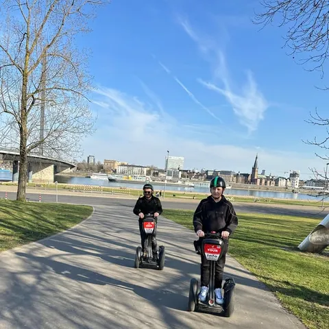
- Rhine Segway Tour from US$91 Duration2 hours[5]Rating4.90 from 189 reviews[5]Live guideGerman, English[5]CancellationFree cancellation up to 24 hours[5] See this tour
- Altstadt Guided Tour from US$218 Duration1.5 - 2 hours[6]Rating4.50 from 488 reviews[6]Live guideGerman, English[6]CancellationFree cancellation up to 24 hours[6] See this tour
The MedienHafen is home to more than 700 companies and some of the best and most popular restaurants in the city.
Should you build a day around the harbour?
Pre-trip notes
A Working Harbour Beside the Cruise Boats
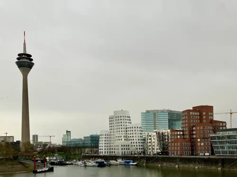
The MedienHafen does not switch off when the tour boats leave. Barges push upstream past the office towers, the water slaps at old quay walls, and gulls work the corners where the basins meet the river. Stand on the Rhine embankment promenade and you get both things at once: river traffic on one side, glass facades on the other, and the Rhine Tower rising behind them. Early morning is the quietest hour, when the water is flat and the first boats are still tying up. By evening the same stretch is full of people walking, cycling and sitting on the steps with a drink.
This is why a cruise or a walk here beats a quick photo stop. From the water you can see how the basins, the quays and the new buildings fit together, and how the working river runs right past the glass. On foot you notice the small things: bollards, iron ladders, high water marks on the walls and the sudden open view at the end of each street. Give the district an evening and a morning and you have seen it in two different moods.
The MedienHafen is home to more than 700 companies and some of the best and most popular restaurants in the city.[3] Expect the quays to fill at lunchtime and again after work, when the terraces open and the lights come on across the water.
How the Former Dockland Became MedienHafen
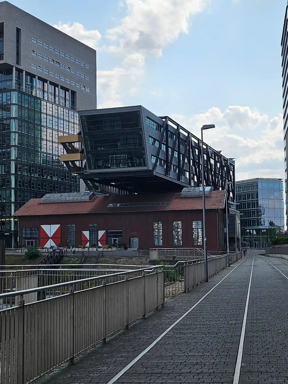
Dusseldorf's city planners and developers reimagined the vacant former working harbour as the MedienHafen media district during the 1980s and 1990s.[10] The same stretch had been docks at the end of the 19th century, at the southern end of the Rheinuferpromenade, and they played a part in the city's boom until the end of WWII.[11] What you walk through now is a former industrial edge that was kept and rebuilt rather than flattened and forgotten.
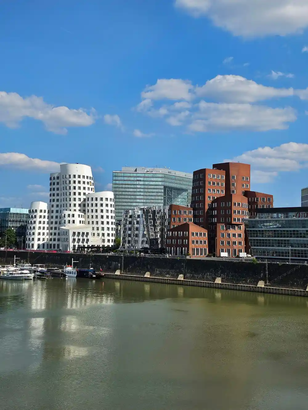
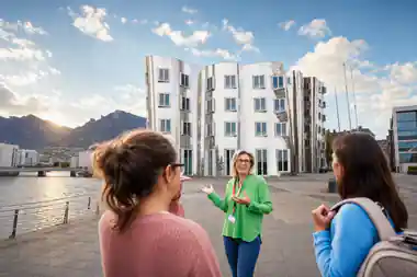
The Frank Gehry complex here is the Neuer Zollhof, three buildings completed in 1999.[12] Walk round them slowly. The walls lean and curve, there is no obvious front, and the same building looks different from each side as the light moves off the water and the glass. Photographers gather at the basin edge in the late afternoon, and the shapes read as pure silhouette after dark.
The Colorium was designed by the British architect Will Alsop and stands 17 stories tall along the Rhine.[13] It reads as a bright, glassy counterpoint to the paler towers nearby, and it is the other facade most people stop to photograph on the walk between the promenade and the Old Town.
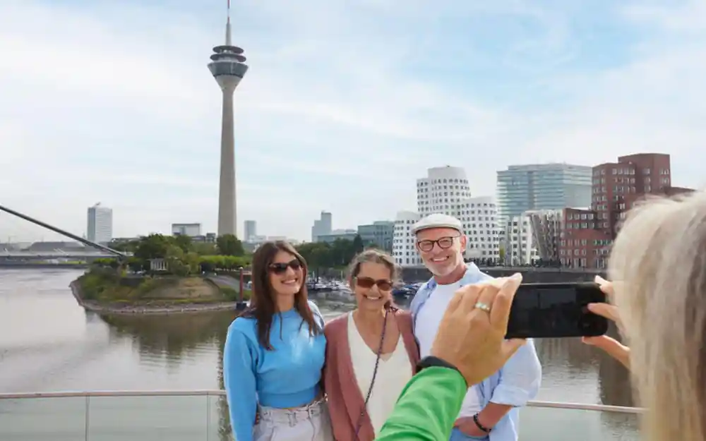
Quay walls, glass towers and the working Rhine in one view
What You Can See From the Water
A Düsseldorf river cruise is the simplest way to see how the city meets its water. Boats leave from the promenade and pass the harbour mouth, the bridges and the Altstadt waterfront, with the tower blocks of the MedienHafen on one bank and the old town on the other. A one hour city sightseeing cruise on the Rhine starts from US$23 and is rated 4.07 from 3,163 reviews.[2] It also works on a grey day, when the windows are warm and the deck is quiet.
The MedienHafen Tour runs for 2 hours with a live guide in German and English, from US$218, and a private group option is available.[1] If you want the river at the end of the day, a one hour city sightseeing cruise starts from US$23.[2] In the colder months there is a two hour winter afternoon boat cruise on the Rhine from US$32, listed as wheelchair accessible.[14] Back on land, Rhine Tower entry tickets start from US$14 and skip the ticket line.[8]
Water Levels, Currents and the Shape of the Harbour
The Rhine is 1320 km long, and the stretch past Düsseldorf is a working navigation.[15] Water levels move through the year, and the harbour looks different depending on when you come. Sometimes the river sits well below the quay edge and you can see the old stone courses; sometimes it runs high and fast past the basins, carrying branches, silt and the odd tree downstream.
In 1995 the Rhine crested at 10.69 metres at Dusseldorf, testing the harbour's flood defences.[16] That is the kind of number harbour engineers plan around, and it gives you a sense of scale when you stand on the promenade and look at the walls below you. The river is never the same two weeks running.
Anyone planning time on the water should watch the level. Landing stages sit higher or lower with it, and the river you meet in late summer is a different river from the one a wet winter leaves behind. Boats still run, but the route and the mood of the water change with the height.
from US$218
The MedienHafen Tour runs 2 hours with a live guide in German and English, and a private group option is listed.[1]
Why This Bend of the Rhine Attracted Trade
Rivers do not care where towns would like a port. A bend offers shelter from the current, a wide flat bank leaves room for quays and warehouses, and the inside of a curve gives something solid to build on. Düsseldorf's docks lay at the southern end of the Rheinuferpromenade.[11] Stand on the promenade and the logic of the site is easy to read.
Freight on this stretch is heading downriver towards the sea, and the nearest sea port to Düsseldorf lies along that route rather than on the city's own bank. The city recorded 3,068,803 guest arrivals in 2018.[17] The waterfront now serves visitors as well as freight, and the two uses share the same stretch of water.
The streets behind the quay still show how close the city kept its commerce to the water. Warehouses have become offices, workshops have become studios, and the grid between them is tight enough to walk from the promenade to a bakery and back before your coffee goes cold.
Quays, Basins and the Engineering Under Your Feet
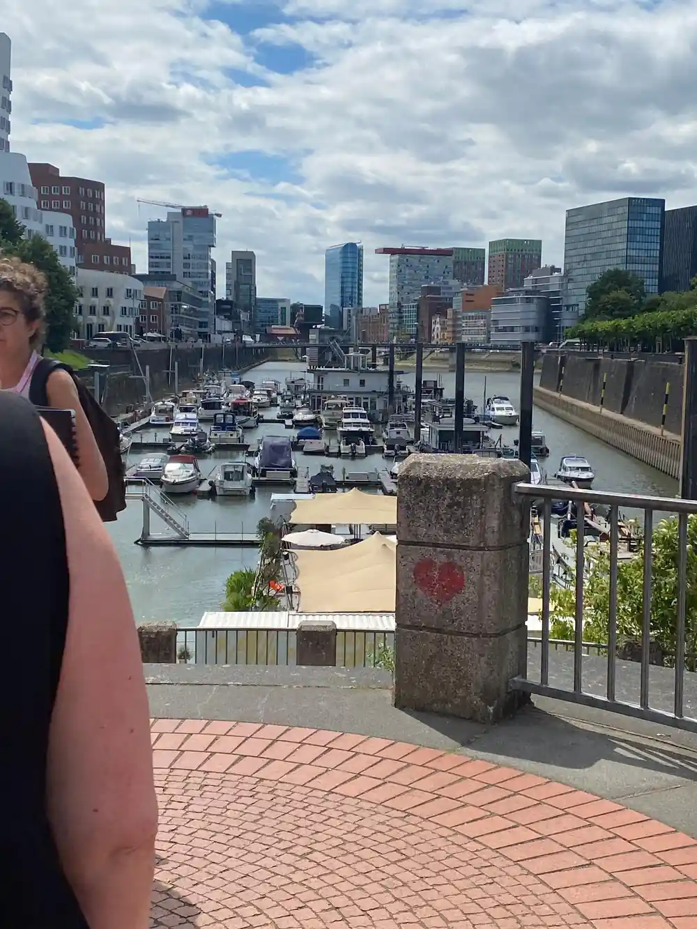
Look over the edge of the promenade and you can read the working parts of a port: concrete walls, iron ladders, stone copings and mooring bollards worn smooth by ropes. Basins were cut into the bank to give ships shelter from the current, with narrow entrances that hold the water calm inside. The whole layout is about shelter and depth rather than decoration.
Rail sidings used to run along quays like these, which let cargo move straight between wagons and a ship's holds. Some of that older hardware is still visible in the paving and along the water's edge, and it sits comfortably next to the glass and steel of the newer buildings.
The Rheinturm is 240.5 metres tall and was built between 1979 and 1982.[4] Its light clock, the Lichtzeitpegel, is an architectural installation by Horst H. Baumann that shows the current time with a vertical series of lights in a simplified decimal layout.[18] After dark the column of lights becomes one more thing to watch on the skyline, and it is the easiest landmark to steer by when you are walking the water.
Flood Defences and High Water on the Rhine
Düsseldorf sits on a river that can climb quickly after heavy rain or snowmelt upstream. Flood protection along this bank is a mix of walls, raised ground and barriers that can be closed off when the water comes up, while the promenade stays usable on ordinary days for walkers, cyclists and anyone with a boat to catch.
It is worth walking the riverfront after a wet winter. You can see how high the water has reached, the marks it leaves on the stone, and the way the quays and the newer buildings are set back to leave the river room. Those marks explain the shape of the harbour better than any diagram could.
Nothing here is dramatic on a calm day. The river looks wide and slow, the boats pass, and the walls simply hold. It is the quiet days that make the engineering behind all of this worth noticing, and the waterfront keeps changing without ever quite losing its working character.
How many travellers have reviewed each tour
Review counts as listed on GetYourGuide for each of these tours.[1][5][6][19]
What the tours cost, at the listed from price
From prices in US dollars for these GetYourGuide listings.[1][2][5][6][19]
When to book and when to go
Plan your harbour day
Start on the promenade
Walk the Rhine embankment promenade first. It is one and a half kilometers long and gives you the whole waterfront in one line.[9]
Look up at the Rheinturm
The tower is 240.5 metres tall and was built between 1979 and 1982, and it is the landmark you steer by.[4]
Circle the Gehry buildings
The Neuer Zollhof is a complex of three buildings completed in 1999, and one lap is not enough to see it.[12]
Book the harbour tour
The MedienHafen Tour takes 2 hours with a live guide in German and English, from US$218.[1]
Add an hour on the water
A city sightseeing cruise on the Rhine starts from US$23 and runs for one hour, which fits an afternoon.[2]
Walk the harbour where the working port still runs
from US$219Reserve now & pay later